Here are my top ten most interesting and amusing street names in Rhode Island. The names of the persons who provided me with the idea for the name and related information are given in parenthesis at the end of the description. This is my list; you may have a different one!
Next week will include a list of 15 honorable mention most interesting and amusing street names; 8 great street names that have disappeared; 5 interesting groupings of street names; and 2 insensitive street names.
This article does not include streets named with Narragansett tribe or other Indian names. Those deserve a separate article. Enjoy! And please do not steal any of these street signs!
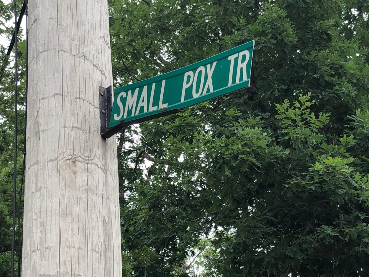
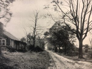
#1: Small Pox Trail (Richmond). The small pox disease was a deadly scourge in the 18th century and was incredibly contagious. Three out of every ten people who got it died. Survivors were left with scars, which were sometimes severe. A common approach of authorities was to isolate the victims so that the disease would not spread. This is likely how the road got its name—Richmond town officials probably used a house on this road as a “pest house” to isolate victims of the disease. It could also have been the house where residents were inoculated by intentionally giving them the disease. This vaccination method was a way to protect a person from catching the disease in the natural way, which was much more deadly. In the early 1800s, vaccination using cowpox helped to reduce the contagion. The Richmond Historical Society’s website states that the road (but not the name) first appears on an 1812 map. The website has two explanations for the possible derivation of the name. The first: “a family that lived at the intersection of Small Pox and Punchbowl Trails were all stricken with and perished from the disease. The house was ultimately burned to curtail the spread of the disease, but a foundation remains.” The second: “At a special meeting of the Richmond Town Council on April 28, 1845, Dr. Edwin Anthony was appointed to attend Ezekiel B. Phillips, a council member, who was believed to have small-pox. The Phillips home became a temporary hospital for Phillips and other persons having been exposed to the disease. Dr. Anthony was authorized by the council to ‘procure vaccine matter’ for vaccination of all those exposed.” In her thorough article published last week, Karen E. Ellsworth established that the last story is how Small Pox Trail got its name. The remaining foundation for the “pest house” is at the north end of the road. (Christian McBurney).
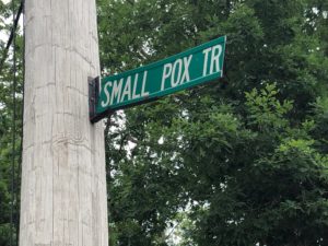
The winner! Don’t steal this street sign! The fact that it is high on a pole helps, although it appears someone has tried to remove it (Christian McBurney)
#2: Transit Street and Planet Street (Providence). Although the names sound modern, they were given in the 18th century to commemorate the 1769 transit of Venus, when the planet Venus moved between the Earth and the Sun. This rare astronomical phenomenon had been predicted by top mathematicians of the day. British scientists were excited about the transit, but it was best viewed in North America. Hoping to show that Providence was advanced in scientific matters, Joseph Brown, one of the famous Brown brothers, and Dr. Benjamin West, professor of mathematics at Rhode Island College (now Brown University), organized the effort to view the transit of Venus from Providence. Joseph Brown purchased the 24-inch reflecting telescope made in London that West used to observe the transit; Brown later donated it to the college, which still has it. Joseph’s brother, Moses Brown, borrowed the colony’s astronomical quadrant from the Redwood Library in Newport. Two excellent clocks were made available, one locally made and the other made in London and belonging to Governor Stephen Hopkins. Preparations began months ahead of time, with a calibrated platform built for the instruments, and daily measurements taken to insure their function. Similar teams observed the event from locations around the globe in one of the first worldwide scientific collaborations. Professor West observed the transit on June 3, 1769, from a platform on what is now Transit Street. The transit of Venus occurred most recently on June 5, 2012. Transit Street runs east-west, mainly between South Main Street and Hope Street near Fox Point. Planet Street runs parallel to Transit Street, about five blocks north, running mainly between South Water Street and Benefit Street. Transit Street was likely named shortly after the historic event. Its name appears on the survey of Providence by Daniel Anthony done in 1803. (Don N. Hagist).
#3: Stub Toe Lane (Portsmouth). This old and short lane runs east and west in between East Main Road (Route 138) and Middle Road. The turn-off on East Main Road is just north of St. Barnabas Church. Perhaps an early settler stubbed his or her toe on a remaining protruding rock after the road had just been cleared and levelled, thus giving the lane its name. The road is on Revolutionary War era maps, but is not named on them. (Russell DeSimone).
#4: Sodom Trail (Exeter). Its derivation is not known. Early Exeter settlers tended to be very religious. Baptists predominated in early Exeter. Of course, Sodom was the ancient city, with Gomorrah, destroyed because of its wickedness. In the dictionary, Sodom also means a very sinful, corrupt, vice-ridden place, giving us the term sodomy. About twenty years ago, a resident of the street requested to change the street’s name, but the request was denied. (Gary Boden).
#5: Purgatory Road (Middletown and Exeter). Purgatory Road in Middletown is named for the impressive steep rock ledges (or cleft) that drops to the bay’s water below, called Purgatory Chasm. It seems the early settlers had a preoccupation with biblical references. One should never try to jump the ten-foot wide chasm (consider the romantic legend of the lover’s leap). (Russell DeSimone). Less well known is Purgatory Road in Exeter. The derivation of the name is not known; there is no chasm near it. It is likely that the biblical reference predominates. In Dante’s Divine Comedy, repentant sinners are depicted in purgatory. The name could derive from a tragedy that occurred in the 1840s. A cemetery at the corner of Purgatory Road at William Reynolds Road contains the graves of eight persons killed in a fire. The story goes that a traveler who looked for lodging at Exeter’s poor farm was rejected on account of his being drunk, and was asked to sleep in the barn. In retribution, he set fire to the main house, killing dozens of people. Driving from Wickford, Purgatory Road is south of Ten Rod Road (Route 102) just past the Exeter Country Club. (Gary Boden).
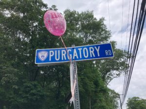
Purgatory Road in Exeter. The pink balloon takes some of the edge off the street name (Christian McBurney)
#6: Monkeywrench Lane (Bristol). This lane is off East Low Lane, which is west of Route 114 just after exiting the Mount Hope Bridge as one drives toward Bristol. The lane has the shape of a monkey wrench, if one draws an outline of the outside of a monkey wrench. This is likely the derivation of the name. Captain William West, who ran the Bristol-Portsmouth ferry, owned the land on which Monkeywrench Lane now exists. His “Ferry Farm” was divided among his six living children with each receiving four lots. The final recorded plan was filed in 1891, with Monkeywrench Lane platted to give access to all of the lots. Most spell the street name as two words, but it is one word. (Patrick T. Conley, a former resident on the lane).
#7: Breakneck Hill Road (Lincoln). Breakneck Hill Road (part of Route 123) is a steep, winding road running west of Great Road just beyond Eddie Dowling Highway (Route 146). The scenery along the short stretch, around its namesake hill and with Lincoln Woods State Park to the south, makes braving the sharp curves worth the trip. Modifications made in the 1990s widened the street and straightened some of the curves, making it a little less treacherous. (Norman Desmarais).
#8: Farewell Street (Newport). This old street, just south of the exit off the Newport Bridge leading to the main area of Newport, leads to and abuts several of Newport’s historic cemeteries, including the east side the Common Burying-Ground and Island Cemetery. Thus, the street name is a descriptive and an apt one. The Common Burying-Ground includes a section for enslaved persons, whose earliest markers date to the 1660s. Called “God’s Little Acre,” it is the oldest and largest existing African heritage burying ground in America. Island Cemetery surrounds the Common Burying-Ground to the north and east. Oliver Hazard Perry, Matthew Calbraith Perry, Richard Morris Hunt, and August Belmont are buried in Island Cemetery, as well as a U-boat submariner killed off Point Judith in 1945. On the west side of Farewell Street are Braman Cemetery and the public North Ground Cemetery. Braman Cemetery, a private Jewish cemetery fenced off from non-Jewish graves as required, has some headstones with inscriptions in Hebrew that can be viewed while driving on Farewell Avenue. St. Mary’s Catholic Cemetery, bordering the Common Burying-Ground to the east, is nearby on Warner Street. (Christian McBurney)
#9: Biscuit City Road (Kingston and Charlestown). According to the traditional story, a peddler once complained in a Kingston tavern that he had called at every house on a road southwest of Kingston and found every family busy cooking biscuits with no time to buy his wares. From then on, the road leading to the bucolic residential neighborhood was called “Biscuit City.” Perhaps the real story is simply that the area was known for talented cooks. In the mid-to-late 1800s, it became an enclave for African-Americans. In 1883, James Arnold in his Narragansett Historical Register magazine gives the traditional story of the name for Biscuit City and in J.R. Cole’s 1889 history of Washington County, he states that the area was then known as Harley’s Mill and was formerly known as Biscuit City. So the Biscuit City name may be older than the 1890s. There is also a Biscuit City Road in Charlestown leading from Worden’s Pond Road north to South County Trail (Route 2). (Christian McBurney).
#10: Ten Rod Road (Exeter and North Kingstown). This road originally served to permit drovers to drive their livestock from farms in eastern Connecticut and western Rhode Island to the wharves of the small but thriving port of Wickford in North Kingstown. The road (now Route 102) was originally ten rods (about 165 feet) wide so as to accommodate flocks of sheep and herds of cattle. The road had a cattle pound at Collation Corner in North Kingstown to gather stray livestock. HistWick, the historical society for Wickford, recently placed a marker explaining the importance of Ten Rod Road on Phillips Street, adjacent to the Wickford Elementary School building. (Brian Wallin)
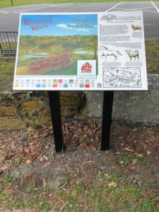
HistWick, the historical society for Wickford, recently placed this marker explaining the importance of Ten Rod Road on Phillips Street, adjacent to the Wickford Elementary School building (Christian McBurney)
[Banner image: Please do not steal this street sign! (Christian McBurney)]

